Home / Platform / Asset Centrl
The core of the platform

Every public asset, on one map. From the catch basin to the snowplow.

Asset Centrl is the GIS-native record system for everything your municipality owns — stormwater, sanitary sewer, roadways, signs, hydrants, fleet, facilities. One source of truth, deeply linked to permits, work orders, inspections, and documents.

Illustrative example
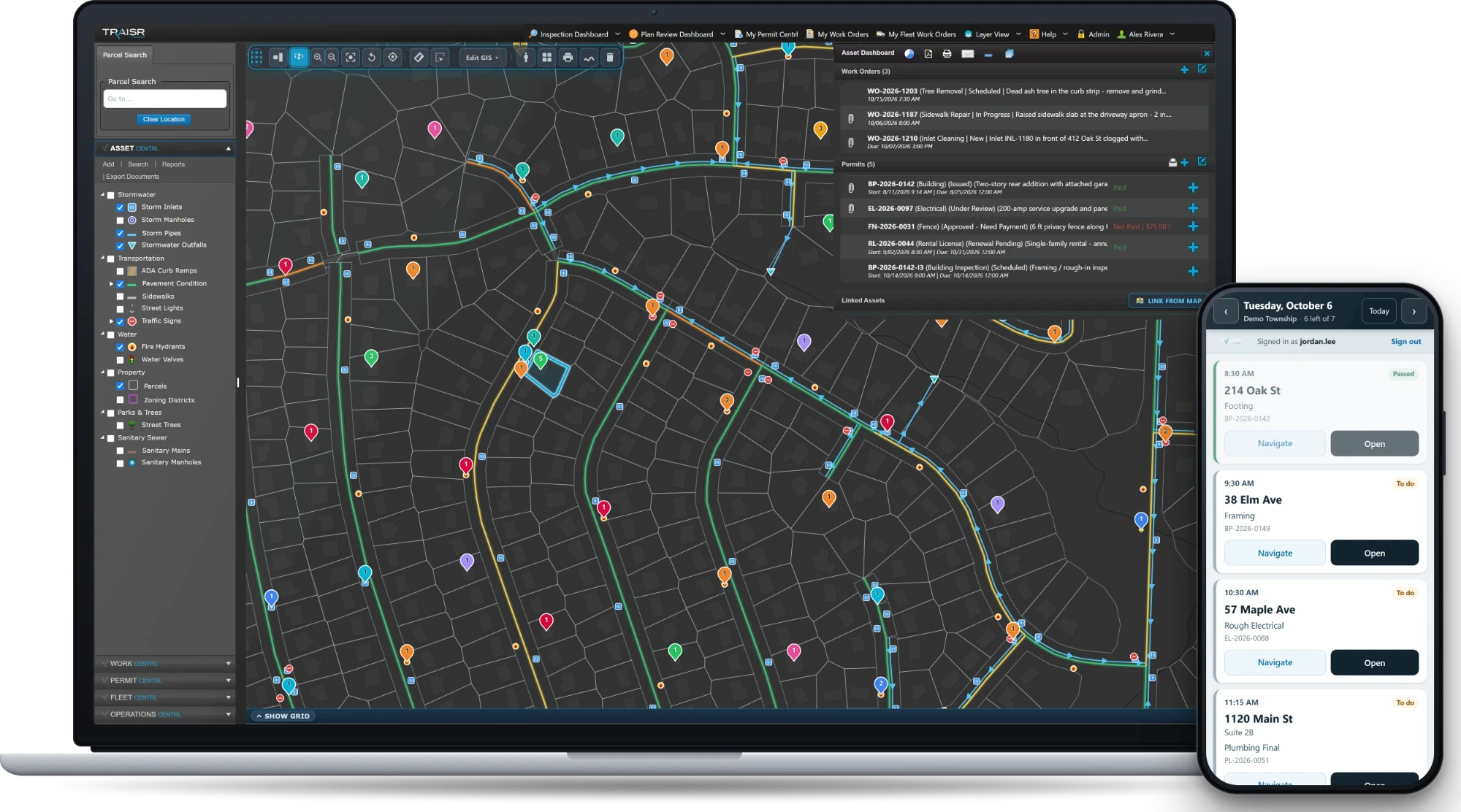
Asset Centrl — a Stormwater Catch Basin record open with the asset dashboard, work orders, documents, images, and linked assets
200+
Municipalities on the platform
Any
Asset type, no exceptions
Any
Hierarchy depth
2.5M+
Residents served nationwide
Capabilities

Built for any asset, anywhere it lives.

No fixed schemas. No off-the-shelf compromises. Asset Centrl bends to your operations — whether you're tracking a 60-year-old sewer main, a fleet truck, or a streetlight that hasn't been touched since the Carter administration.

Asset agnostic

Pipes, poles, parcels, plants, plows, parks. If you can put it on a map, you can track it in Asset Centrl — with the fields, forms, and workflows your team actually uses.

Track conditions

Rate condition on a 1–5 scale, or your own. Trend it over time. Tie inspection results back to the record so you can see why something dropped — not just that it did.

Monitor depreciation

Straight-line, declining-balance, or custom. Show your finance director where the book value is going, and your engineering director where the renewal cliff sits.

Unlimited hierarchy

System → subsystem → asset → component → part. Or whatever depth your operation actually has. Roll-ups, parent/child links, and inheritance all just work.

Customizability

Your fields, your validation, your domain values, your workflows. We configure to your operation — not the other way around. No release cycles to wait on.

Security & access control

Role-based access down to the field level. Encryption in transit and at rest. Full audit trail on every change.

Capability is the easy half. The harder half is keeping every one of those records connected to the work, the permits, the documents, and the inspections that touch them. That's the next thing.

The asset record

One record. Every link. Forever.

Every asset is the center of its own gravity — connected to the work it's needed, the permits that touch it, the documents that describe it, and the inspections that prove it's still doing its job.

Documents & plans

Drawings, CAD, photos, manuals, warranty PDFs. Edit and mark up PDFs in the browser — no separate tools, no downloads.

Work history & inspections

Every WO, every inspection, every callback — auto-attached to the asset and to the crew member who did it.

Permits & right-of-way

When a contractor pulls a permit near your asset, you know. When they close it, the asset's history reflects the change.

ArcGIS & spatial editing

Native ArcGIS integration. Edit spatial data right in the browser. Your GIS team and your field crews finally see the same map.

GIS-NATIVE

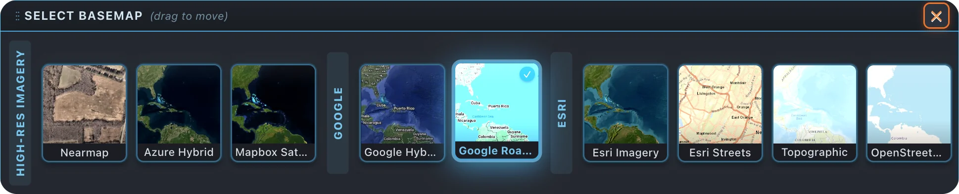
Your map, your view.

Switch between multiple map views so your team works on whatever fits the job.

TRAISR basemap selector — switch between multiple map views.
Features

Everything your team actually reaches for.

Catch basins. Hydrants. Sidewalks. Signals. The asset types your GIS lead actually maintains — plus the document, photo, and inspection trails that prove the work happened.

01

Local government data model

Pre-built schemas for stormwater, sanitary, water, roadway, signs, signals, fleet, parks, and facilities. Modify, extend, or rebuild — it's your data.

02

Cross-platform, HTML5

Phone, tablet, ruggedized laptop, the dispatcher's twin monitors. Same data, same UI, no native app to babysit. Works in the truck, works in the office.

— Get started

Put every asset on the map.

Walk us through your stack — even the spreadsheets. We'll show you how it works on a real map and give you straight answers about fit, scope, and timeline.

No slides Just the product
Request a personalized demo
Request a demo